Line symbols are used to represent the events that are localized on lines (for example, lines of watershed, lines of tectonic breaks) and the demarcating lines (borders of regions, states) and in order to mark objects that have linear character, that are not manifested by its width in a scale such as rivers, roads, shore lines.
The main means for reproduction of object's qualitative and quantative characteristics. (p.1)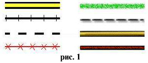 are color, picture and the width of the symbol. On the topographical maps with the considerable width of the line symbol it is placed in such a way that the axis coincides with the true location of the object. On the thematic maps another technic is used as well, when colored or hatched stripe of the symbol is placed at the side, along the line that marks the true location of the object.
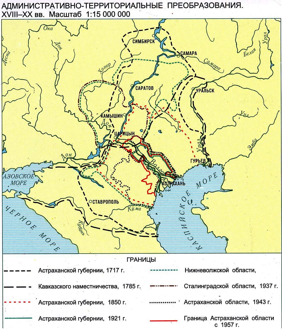
Change of the object's location at the place is represented with the help of combining of the line symbol. For example, change of the state border by the time is represented by the series of lines differed by structure and color. The same change at electronic maps can be represented with the help of animation. Replacing of river lines by each other will help to trace the change of river-beds` location through different geological epochs. Pulsatory lines of the rivers can show the degree of their usage for shipping, and different shades - the season of navigation. According to programme or manipulation provided by the user it is possible to define the type of rivers' nutrition, time of the flood and freezing by the pulsatory lines of the rivers. Historical development of the road network can be traced by using growing lines of roads or lines that grow in width for demonstration of traffic flow growth. Pulsatory roads can show not only sections of arterial roads that are under construction, but also the most overladen streets in the rush-hours, and possible routes of its detour, for example at the map of Moscow. Besides, the changing width of road lines can show dynamic of traffic change thought the day. Change of the shoreline position allows to learn the dynamics of rises and falls of the earth's crust at its single sections and in different geological epochs.
are color, picture and the width of the symbol. On the topographical maps with the considerable width of the line symbol it is placed in such a way that the axis coincides with the true location of the object. On the thematic maps another technic is used as well, when colored or hatched stripe of the symbol is placed at the side, along the line that marks the true location of the object.
Change of the object's location at the place is represented with the help of combining of the line symbol. For example, change of the state border by the time is represented by the series of lines differed by structure and color. The same change at electronic maps can be represented with the help of animation. Replacing of river lines by each other will help to trace the change of river-beds` location through different geological epochs. Pulsatory lines of the rivers can show the degree of their usage for shipping, and different shades - the season of navigation. According to programme or manipulation provided by the user it is possible to define the type of rivers' nutrition, time of the flood and freezing by the pulsatory lines of the rivers. Historical development of the road network can be traced by using growing lines of roads or lines that grow in width for demonstration of traffic flow growth. Pulsatory roads can show not only sections of arterial roads that are under construction, but also the most overladen streets in the rush-hours, and possible routes of its detour, for example at the map of Moscow. Besides, the changing width of road lines can show dynamic of traffic change thought the day. Change of the shoreline position allows to learn the dynamics of rises and falls of the earth's crust at its single sections and in different geological epochs.